139
Hike on Two Forks of Dismal Creek, Glory Hole Area
12/26/13
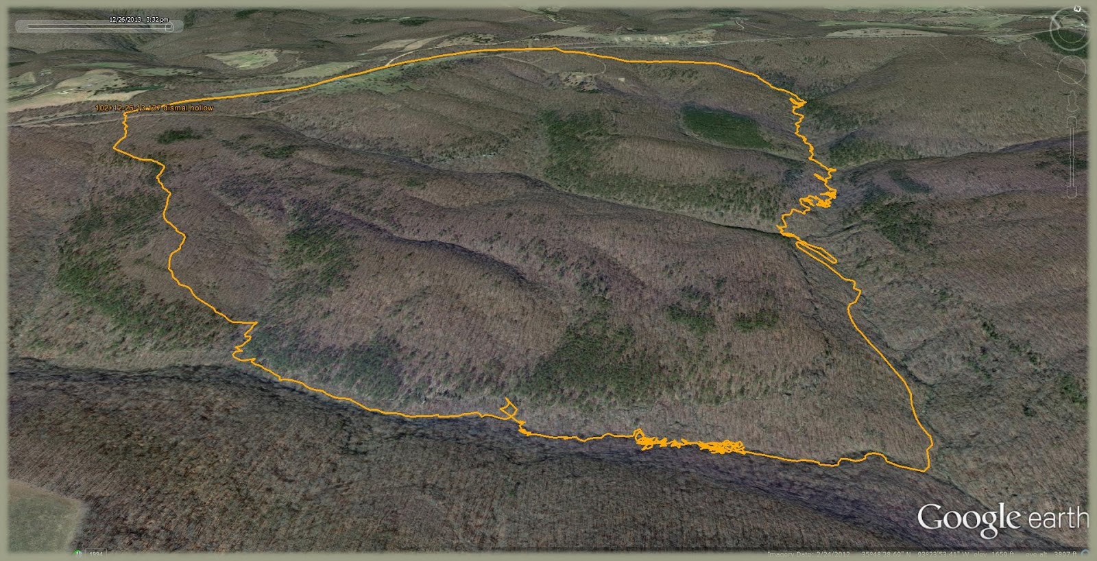
Many a hiker is aware of the Glory Hole in northwest Arkansas. It has become a short hiking destination similar to Hawksbill Crag and both are Ozark icons. Each are easily accessible and the Glory Hole can even be reached by 4-wheeler if you are a lazy bastard. This landmark is just the beginning to a splendid valley below. The creek that flows through this orifice is the north fork of Dismal Creek. The western fork comes in about mile or so downstream. Dismal Creek is a tributary in the upper reaches of Big Piney Creek. Those familiar with the lower Piney around Long Pool might be amazed at the extent of the watershed the Big Piney drains. This area has interested me for some time so it's about I explored it. Let's do that now.
Thursday morning after Christmas I headed up around 2:30 a.m. and ate breakfast at Waffle House in Clarksville. At 5:45 I was hiking up the Hwy 21/16 to my entry point and came to the Glory Hole at 6:35. Sunrise was around 7:20. There was not a whole lot to see in the dark so down the creek I did go. Not much of interest was noted for a good while but the creek eventually showed some character after 30 minutes of hiking. There is a nice bluff line on the western side that I followed for bit. When the west fork entered from the west it was followed in a westward direction and by looking at the sun I did confirm that I was...indeed...moving towards the west. This branch was steeper and had more rocks and stuff. Lunch at noon was partaken of on top of a huge boulder along side the creek. Around 2:45 I started the ascent out and encountered a couple of creeks spilling over the bluff creating nice waterfalls. The second one afforded a spot to climb to the top of the bluff line. After a goodly uphill hike I was on my way towards the road. Temp on entry was 32° and it warmed to around 50° with calm winds and a super sunny sky. This was a perfect day for hiking and all the rain we had last weekend left plenty of water in the creeks. The hike distance was near 7.5 miles. I arrived back at the start point at 3:30. I then drove home where I ate some food.